Tag: digitaler Zwilling

  • BIM and digital twins the digital partners of buildings

    BIM and digital twins the digital partners of buildings

    BIM, Building Information Modelling, replaces static 2D plans with a shared, digital building model in which architecture, technology and costs interact in real time. All components are recorded as BIM objects with dimensions, services, prices, warranty and maintenance information, from the brickwork to the door, from the sensor to the pump.

    Instead of sending plans back and forth, everyone involved works in the same 3D model, recognises collisions early on and experiences the building virtually before the first excavator rolls in. This reduces the risk of errors, makes deadlines easier to plan and lays the foundation for clear budgets instead of later addenda.

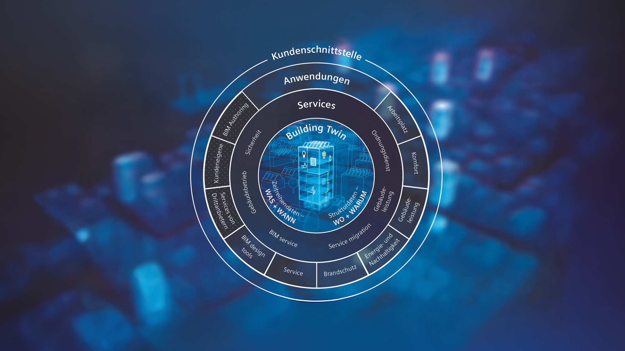
    From the BIM model to the building twin
    The digital twin is created from the BIM model during operation. The building twin, which takes over up to 95 per cent of the planning information and links it with live data from the building. It forms the “single source of truth” for areas, technology and sensors and visualises performance, occupancy and comfort levels in real time.

    Cloud-based building twin platforms enable buildings to be monitored virtually, scenarios to be simulated and new applications to be scaled quickly, from energy monitoring to user-centred service suites with AI analytics. This transforms the rigid plan into a learning system that evolves with the requirements of operators, tenants and cities.

    Added value in operation instead of just on the construction site
    Around 80 per cent of a building’s life cycle costs are incurred during operation. This is precisely where BIM, in combination with digital twins, has the greatest leverage. Facility managers access maintenance cycles, operating instructions, manufacturer and warranty data in the 3D model, plan conversions precisely and reduce downtimes and journeys.

    Structured product and live data allow predictive maintenance, bundled procurement or automated reactions such as closing blinds in the event of severe weather warnings. At the same time, the transparent database supports ESG goals, decarbonisation and the circular economy, from energy and water tracking to the valuable reuse of materials in dismantling.

    Digital ecosystems as a model for the future
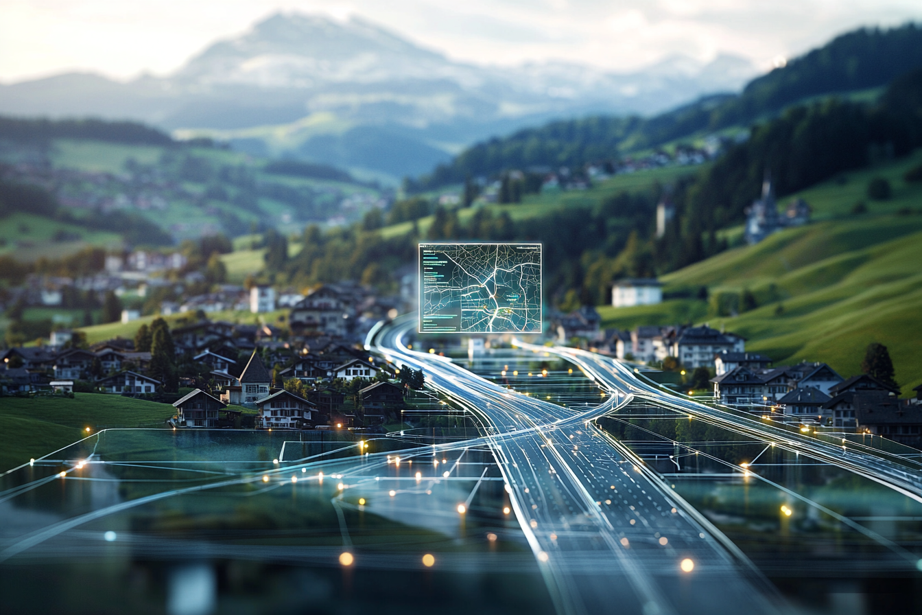
    Digital twins connect buildings, campuses and neighbourhoods to form intelligent ecosystems in which energy, use and mobility are coordinated. They provide insights into comfort, health, utilisation and emissions and help to manage net-zero strategies, new working environments and mixed-use urban building blocks based on data.

    For owners and operators, BIM and digital twins are thus becoming market differentiators. Those who understand their own portfolio digitally can better prioritise investments, manage risks and prove the return on investment of refurbishments, conversions and services. In an industry caught between decarbonisation pressure and user expectations, they are becoming the key to transforming properties from static objects into adaptive, future-proof infrastructures.

  • Digital twin makes the invisible visible

    Digital twin makes the invisible visible

    At the heart of the project is a digital co-pilot that acts as an intelligent assistant and supports restoration decisions. Laser scans and photogrammetric images are used to create a precise 3D twin of the cathedral, supplemented by detailed data on each stone. Age, material composition and condition are scientifically documented

    At the same time, the mechanical loads in the building are simulated using methods such as Thrust Network Analysis. Damage is not only visible, but also localized in space and its development can be traced. The XR technologies show restorers, engineers and architects interactive holograms directly on the original building

    Climate as a challenge
    The ETH Zurich team correlates local weather extremes such as wind-driven rain with the real damage patterns on the sandstones. Sensors measure humidity and microclimate; the data obtained flows into models that predict future developments in the event of increasing climate change. This results in strategies for the long-term preservation of the building fabric, adapted to the individual climatic stresses at the location

    New standards for buildings worldwide
    The “Heritage ” project is a role model for digitalization in heritage conservation. The combination of digital twin, XR and AI is transferable to bridges, castles and other historic buildings. The public app for the anniversary of the cathedral communicates restoration work to visitors in a transparent and participatory way. Monument conservation not only becomes more efficient, but can be experienced by everyone.

  • 3D data platform optimizes transport and infrastructure projects

    3D data platform optimizes transport and infrastructure projects

    INovitas AG, based in Baden, and Geoinfra Ingenieure AG, based in Wetzikon, have created a digital twin of the road network in the Zurich Oberland. According to a joint press release, around 800 kilometers of roads will be available in the high-resolution infra3D data platform. Interested user groups can license the data with immediate effect and use it for their planning and decision-making processes, according to the press release.

    The two companies have mapped the road networks of the municipalities of Bäretswil, Bauma, Bubikon, Dürnten, Fehraltorf, Fischenthal, Gossau, Greifensee, Grüningen, Hittnau, Hombrechtikon, Männedorf, Mönchaltorf, Oetwil a.S., Russikon, Rüti, Seegräben, Stäfa, Uetikon a. S, Wald, Wetzikon, Wila and Wildberg are digitized. The project provides the Zurich Oberland region with a precise and up-to-date basis for traffic, urban and spatial planning. This means that data-based simulations can be improved and on-site inspections can be reduced.

    “Data is the basis for well-founded decisions”, comments Hannes Eugster, CEO and founder of iNovitas AG, in the press release. “With the digital mapping of the Zurich Oberland region, we are providing a precise and immediately available database that can be used by a wide range of stakeholders – whether for transport planning, infrastructure projects or urban development.”

    Patrick König, member of the management board of Geoinfra Ingenieure AG, emphasizes the importance of the digital project: “Access to georeferenced, high-resolution 3D data represents a paradigm shift for infrastructure planning. Our collaboration with iNovitas enables administrations and companies in the Zurich Oberland region to benefit from data-driven, efficient and sustainable planning”.