Tag: raumentwicklung

  • Lucerne presents structure plan to the public

    Lucerne presents structure plan to the public

    According to forecasts, the population of Lucerne will increase by around 120,000 people by the middle of the century and reach the 560,000 mark. In order to manage this growth in an orderly manner, the spatial development strategy sets out clear objectives in the structure plan. Priority should be given to compact, efficient settlement structures based on public transport.

    The plan ensures the economical use of land and coordinates the canton’s development plans with those of the federal government and the municipalities. It is intended to create the basis for spatially harmonizing living, working and mobility.

    Focus on inner development and affordable living space
    The central element of the revision is the creation of living space without endangering valuable cultivated land. The structure plan focuses on inward densification, for example through minimum densities and higher building densities in locations with good transport links, and allows selective extensions to building zones where they make sense for affordable housing construction.

    The so-called center areas create planning instruments for the targeted development of central locations with high densities. In future, municipalities will be able to make their housing supply binding. In addition, measures are needed in other policy areas, such as land policy or support programs for non-profit housing construction.

    Work zones and economic development
    The structure plan strengthens the local scope for action for economic areas. Municipalities are given the opportunity to expand their own work zones in order to promote new settlements with a regional connection and to link living and working more closely.

    The canton assumes a coordinating role with the program for development priorities. In addition, the structure plan creates the basis for an active land policy in order to develop areas in the canton’s interest. Such as strategic employment areas or infrastructure projects.

    Integration of overarching sustainability goals
    The structure plan revision links spatially relevant topics with overarching strategies. Aspects relating to climate protection, energy production and mobility development from cantonal projects such as “Future Mobility Canton of Lucerne” or the Climate and Energy Planning Report are anchored spatially. In this way, planning integrates ecological, economic and social developments.

    Procedure and political responsibility
    Since the revision of the Planning and Building Act in 2018, the Cantonal Council has been more closely involved in structure planning. It defines the strategic objectives in the spatial development strategy, while the cantonal government is responsible for operational coordination and the concrete spatial definition in the structure plan maps.

    The current revision is based on feedback from the 2023 consultation and the preliminary federal review in 2024. After the public consultation, all submissions will be evaluated before the revised version is forwarded to the Cantonal Council, probably in summer 2026, and then submitted to the Federal Council for approval.

  • Potential for residential construction and internal development

    Potential for residential construction and internal development

    Residential construction is a key factor in sustainable urban and spatial development. Switzerland is faced with the task of creating new living space without unnecessarily taking up valuable land outside existing settlement areas. The findings of the Federal Office for Spatial Development show that the construction of existing housing in particular will play a key role in future development. However, this is associated with more complex challenges than new construction on previously undeveloped land.

    Where are new apartments being built?
    An analysis of residential construction activity between 2018 and 2022 shows clear patterns. Rural and peri-urban municipalities show a higher level of new construction activity in relation to their primary housing stock than urban areas. Nevertheless, the proportion of new builds on previously undeveloped building plots has decreased overall, while the proportion of construction in existing buildings now accounts for 59% of building permits. In urban areas, residential construction is increasingly concentrated in existing residential areas, while growth continues to be recorded on the outskirts of settlements.

    The challenge of building on existing properties
    Building housing on existing sites is more complex than developing new building areas. One key finding is that municipalities with large undeveloped building land reserves have less building activity in existing areas. The pressure for redensification is lower where there is still sufficient space for new buildings. At the same time, targeted measures by the municipalities and high-quality construction projects can make a positive contribution to inner development and create incentives for the use of existing structures.

    Drivers of and obstacles to building activity
    Building activity on undeveloped land is easier to analyze as it is strongly influenced by measurable factors such as property price trends and rent levels. Case studies show that municipalities with an active housing policy have a higher rate of inner-city development. Municipal measures such as targeted advice, land policy or attractive public spaces can provide decisive incentives for redensification.

    Quality as the key to acceptance
    Another success factor is the quality of the construction projects. Social acceptance is higher when construction projects not only create additional living space, but also contribute to the quality of the settlement. This includes publicly accessible open spaces, the promotion of biodiversity and socially acceptable housing. Such quality criteria are particularly important in inner-city development, as structural changes often take place in the direct residential environment of the residents.

    Settlement development a long-term change
    Ten years after the Spatial Planning Act came into force, initial data shows that the transformation towards inner-city development has begun. Particularly in urban areas such as Zurich, Basel and Lausanne, more and more apartments are being built by converting or adding storeys to existing buildings. However, there is also an increasing trend in peri-urban and rural communities towards the use of already built-up areas.

    Strategies for residential construction
    The analysis of residential construction activity shows that targeted control through spatial planning is possible. Municipalities that actively promote inner-city development are better able to meet the challenges of residential construction. Successful strategies include a forward-looking land policy, high-quality construction projects and close cooperation between the public and private sectors. Inner development remains one of the central tasks for future-oriented spatial development in order to meet the growing demand for housing in a resource-efficient manner.

  • Using living space more efficiently through innovative collaboration

    Using living space more efficiently through innovative collaboration

    (CONNECT) Researchers at OST – Ostschweizer Fachhochschule want to optimize the use of living space through better collaboration. Their project WOGE – Wohnzukunft gestalten supports people who want to downsize their living space with local offers for moving, renovating or finding new flatmates, explains OST in a press release. For WOGE, the OST researchers are working together with the spatial development office Planteam S(plan:team) from Lucerne. The project is also supported by the Swiss Innovation Promotion Agency(Innosuisse) and the Federal Office for Housing.

    WOGE is to be implemented as a pilot project in Aarau, Köniz BE and St.Gallen. The project will kick off next year in the cantonal capital of Aargau. The results from Aarau will then be evaluated and optimized in the Bernese municipalities of Köniz and St.Gallen. Plan:team intends to offer the experience gained from the pilot municipalities to other municipalities as part of its consulting activities.

  • 101. immoTable – Geneva economic area

    101. immoTable – Geneva economic area

    [smartslider3 slider=”16″]

    The 101st immoTable, the renowned event for the property industry at Signatur Rhône in Geneva, focused on important topics that will have a significant impact on the future of the property world. From sustainable spatial development and geothermal energy as part of the energy transition to health risks in water and legal issues relating to renovations in Geneva, the event provided a comprehensive platform for dialogue on current challenges and innovations in the sector.

    The Director of the Department of Territory of the Canton of Geneva, Marta Alonso, presented pioneering urban development and spatial planning projects. By 2060, over 12,000 new residential units, 6,000 workplaces, schools, a large park and revitalised river areas are to be built on an area of 230 hectares. Modern visualisation techniques and 3D models enable a transparent presentation of the development scenarios.

    David Faehndrich, Head of the Western Switzerland division at EKZ Contracting SA, emphasised the role of sustainable and economical energy supply systems. Several important projects have already been realised, such as the geothermal energy supply for the new flats in the “Jardins du Bourg” in Châtel-St-Denis. These measures reduce CO₂ emissions and promote the energy transition.

    In his presentation, Pierre Descloux, CEO of Dipan SA, emphasised the importance of treating hydraulic systems, particularly with regard to rust, limescale and legionella. He emphasised the importance of ensuring the hygiene and efficiency of these systems.

    Cosima Trabichet-Castan, a specialist in property law at MLL Legal, spoke about the challenges of obtaining planning permission and complying with local building regulations. She also spoke about the complex regulatory requirements in Geneva, which according to a recent UBS study has the longest waiting times for building permits in Switzerland. Her presentation highlighted the importance of integrating sustainable practices in this context-rich regulatory environment.

    Fabio Nairi from IWG Switzerland spoke about measures to reduce commuting times and CO₂ emissions as well as the transition to hybrid working models.

    The 101st immoTable once again proved why the event is one of the top platforms for the property industry. The topics discussed are of key importance for the future development of the industry and offer valuable solutions for current challenges.

    Further information on the event and future dates can be found at www.immotable.ch

  • Planning in Geneva: a difficult exercise

    Planning in Geneva: a difficult exercise

    The Office de l’urbanisme is responsible for spatial planning in the canton of Geneva. Can you give us an overview of your responsibilities?
    The Office de l’urbanisme develops and implements a land use policy that aims to promote housing, economic, social and cultural development while improving the living environment in terms of ecological transition and enhancing the natural and built heritage. It is the gateway for all territorial projects and ensures a permanent and iterative dialogue between the local and regional levels and between the public policies that affect these projects (nature, landscape, mobility, land, social, health, economy, etc.).

    One of the instruments is the cantonal structure plan, which provides general guidance on the major spatial balances, particularly in coordination with the neighbours in France and Vaud. The town planning office is also responsible for zoning changes in order to adapt the uses to the needs of the area, as well as for master plans such as the neighbourhood plans or the localised neighbourhood plans, which specify the layout of the buildings, organise the outdoor spaces and distribute the building rights.

    Since 2015, the urban planning office has had a department for citizen participation, which is a centre of expertise for all the consultation processes that accompany all projects. Indeed, the consideration of the population and their utilisation expertise in the projects has been further strengthened by the consultation approaches. In order to understand how the area is inhabited and to enable the projects to take better account of the residents’ wishes, sociological studies are increasingly being integrated into the basic studies of the projects in addition to the participatory approaches.

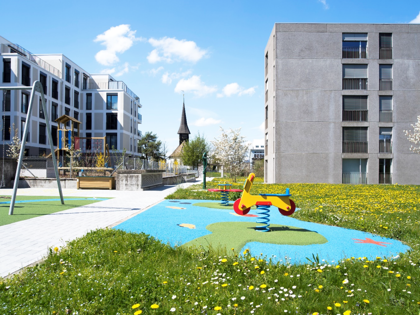
    To accompany the construction of the Léman Express intersections, the urban planning office has also created an operational directorate responsible for public space projects: squares, greenways for non-motorised traffic, school playgrounds, parks, etc.

    What challenges and opportunities does urban development in Geneva face, especially in comparison to other Swiss cantons?
    The biggest challenge today is to accommodate this growth in a high-quality manner in an increasingly confined and limited space.

    For decades, the territory of Geneva has preserved its agricultural and natural areas as well as its landscapes, allowing it to offer its inhabitants a high quality of life. This constant attention between preservation and development has led it to play a pioneering role in the urban process of inward growth. The challenge today is to accommodate this growth within existing settlement structures, but also to initiate positive processes of regeneration and redevelopment of already urbanised areas. Climate resilience requires us to redesign public spaces by better managing water infiltration, unsealing soils and increasing vegetation cover. At the same time, the energy refurbishment of existing buildings must lead to significant savings while switching to renewable energy sources.

    This challenge of building the city on already built-up areas must also address the preservation of the built heritage and trees as well as the consideration of biodiversity in the urban environment.

    Which areas in Geneva are particularly attractive for companies and why?
    Geneva’s built-up area is particularly dense and compact. Companies in the secondary sector benefit from the high-quality industrial areas that, through the “Ecoparc”, aim to both dynamise the economic fabric and take into account the challenges of adapting to environmental change: better water management, greening, energy efficiency, circular economy, etc. These industrial areas are generally well connected to transport axes and some have a railway connection.

    The more mobile service activities have recently seen significant relocations to take advantage of new “addresses” that are better located, more modern and, above all, better connected to the mobility networks. In this quest for optimisation, the new business districts of the PAV have proved very attractive, especially those located close to the Léman Express stations. We can see that companies are paying attention to various parameters, including location, transport links (public and private), the local amenities offered in the neighbourhood, the flexibility of the premises and the environmental friendliness of the buildings.

    What are the most important construction projects in the canton of Geneva and how do they contribute to urban and spatial development and which projects would you describe as flagship projects and for what reasons? Where does urban and spatial development in Geneva still see development potential and how could this be utilised?
    Current urban development mainly consists of three large project families:

    The “large-scale projects” as urban expansion on agricultural land. These projects were conceived around ten years ago and have gone through the entire process from inclusion in the cantonal structure plan to zoning changes and neighbourhood development plans. Each of these projects comprises several thousand flats, commercial space, amenities and public facilities. They are all in the construction phase, which will last in stages until 2040.

    The urban regeneration projects in the Villa zone. These projects have great potential for new housing, but their planning is tricky due to the impact on the existing fabric, which not only has a natural resistance to change, but in places also has patrimonial and environmental qualities that require delicate balancing of interests.

    The third large family concerns the densification of the urban crown, including the “Praille-Acacia-Vernet (PAV)” sector and the Léman Express railway station districts. While the latter are in the final stages of completion and offer housing and commercial space with excellent transport links, the PAV sector aims to transform an industrial area of over 200 hectares into a new city centre. Far from a wasteland, this dynamic sector is now in operation and requires the relocation of companies to ensure their continuity in Geneva’s economic fabric.

    Are there any unused sites in Geneva that could be considered for new development projects? If so, where are they located?
    As already mentioned, the canton of Geneva is forced to develop inwards and regenerate its settlement area. Unlike other cities, there are no urban brownfields in Geneva, as these are often associated with deindustrialisation. Thus, urbanisation is mainly driven by the mutation of existing building zones, with the perspective of equipping the area to promote proximity practices.

    The quality of life is improved through the renewal of neighbourhoods. This includes the redesign of public spaces, the provision of facilities and services for the neighbourhood, the preservation of the built and natural heritage and easier access to recreational spaces. In this sense, the villa areas from the last century now represent the greatest potential for mutation for development projects in the canton.

    Geneva’s ambitions to preserve its natural and agricultural areas are supported by the Sectoral Plan for Crop Rotation Areas (SDA), which aims to preserve a quota of 8400 hectares of high-quality agricultural land to contribute to Geneva’s self-sufficiency. As this limit has practically been reached, future large urban expansions in the agricultural zone are no longer possible.

    Has the pandemic led to long-term changes in Geneva’s planning? If so, which ones?
    The pandemic was a moment in which the collective awareness of the close link between lifestyles and the city’s production was heightened.

    Indeed, the lockdown has been a real experience of urban resilience for all in a context where adaptation to climate change is necessary. It has also highlighted the need for a diverse city capable of offering services, places of relaxation and recreation close to a neighbourhood. The quality of public spaces is therefore of crucial importance, as is the networking of parks and gardens. In hot summers, access to water is also important and has led to a complete reorganisation of the use of lakeshores and watercourses by opening up walking paths and creating new recreational areas (banks of the Rhône, Eaux Vives beach, Vengeron beach, etc.).

    The need for leisure and recreation also put pressure on the agricultural and natural areas, with a high level of footfall during the pandemic, mainly due to the closure of borders. Today, thought is being given to the “socio-ecological” management of these areas to try to reconcile agricultural activity and the preservation of ecosystems, while allowing reasonable access for the public.

    How do you envisage the ideal development of the canton of Geneva? What would be the key elements?
    The development of the canton of Geneva primarily requires the preservation and valorisation of its agricultural and natural areas, both for reasons of biodiversity, food production and the landscape.

    New potential will therefore ideally be located in the already built-up area, partly in urban regeneration and partly in the densification of the villa zone.

    The vision underlying the development aims to promote a dense, green city that offers services and amenities nearby and locates future developments in areas that are well connected to mobility networks (active mobility and public transport). Neighbourhoods that offer diverse reception conditions and support a mix of generations, that are green and designed for all types of people, soft mobility networks that connect living spaces (housing, work, education, leisure, etc.) A self-confident urbanity of a dense city that knows how to contextualise building typologies and fully involve residents in their planning and implementation.

  • Swiss municipalities keep proportion of second homes stable

    Swiss municipalities keep proportion of second homes stable

    The latest survey by the Federal Office for Spatial Development (ARE) shows that the proportion of municipalities that no longer permit new second homes remains significant. Around one in six Swiss municipalities is affected by this decision, and this figure has only risen slightly compared to the previous year.

    Interestingly, Switzerland now has a total of 340 municipalities with a proportion of second homes of over twenty per cent. In these municipalities, new second homes are only permitted under strict conditions, as stipulated in the Second Homes Act. Particularly affected are areas in the Alpine arc, the foothills of the Alps, occasionally in the Jura and on lakes.

    The municipalities carry out their annual housing inventories to determine the number of second homes. The results are published by the ARE at the end of March each year. Municipalities whose proportion of second homes is now over twenty per cent then have 30 days to comment and clarify their inventory. If the proportion remains above twenty per cent, the Second Homes Act, which regulates the construction of new second homes and is based on the Second Homes Initiative adopted in March 2012, applies.

    This development underlines the efforts of Swiss municipalities to regulate the issue of second homes in accordance with legal requirements and to maintain the balance between recreational and residential use in their regions.

  • HSLU launches Master in Collaborative Spatial Development

    HSLU launches Master in Collaborative Spatial Development

    Lucerne University of Applied Sciences and Arts is offering a new Master’s degree course in Collaborative Spatial Development from this autumn semester. The programme is open to students from disciplines such as spatial planning, urban planning, architecture, landscape architecture, environmental sciences, economics and social sciences, the HSLU explains in a press release. “More than ever, the spatial development of the future needs interdisciplinary and transdisciplinary teams to find appropriate solutions to current challenges,” Tabea Michaelis is quoted as saying in the press release. She will lead the new Master’s degree programme together with her colleague Amelie-Theres Mayer.

    The programme aims to prepare its graduates for the complex challenges of future spatial transformation processes. The focus is on dealing with changing requirements and increasingly scarce resources. The teaching programme includes involving groups with different requirements in the planning process and mediating between them.

    “We don’t see spatial development as a product, but as a process,” explains Michaelis. According to the co-director of the degree programme, the aim of such processes is to create climate-friendly, open and adaptable spaces. “Planning these spaces requires a holistic understanding of building culture that starts from the existing building stock and keeps an eye on the political and legal framework as well as economic viability.” To this end, students are expected to work together with potential project clients in a practical manner.

  • Property prices in the mountain region are on the rise

    Property prices in the mountain region are on the rise

    The ZWG, which was passed in 2015, has now largely halted the construction of new second homes in mountain areas, the Federal Office for Spatial Development(ARE) informs in a press release. In cooperation with the State Secretariat for Economic Affairs, the ARE regularly monitors the effects of the law. According to the current monitoring, the impact of the ZWG on the construction industry and the hotel industry in the mountain region is low.

    “On the other hand, it has become difficult for locals and workers in the mountain area to find affordable housing,” writes the ARE. However, the experts at the Federal Office do not attribute this exclusively to the ZWG. Rather, the low interest rate environment and the possibility of working independently of location have also increased the demand for second homes. As a result, the supply overhang of second homes identified in the first monitoring in 2021 has disappeared in many places. Instead, an increasing number of so-called old-law flats that are free for use are being put on the market as second homes.

    The difficulties for the resident population, newcomers and employees to find affordable housing have led to “displacement and migration”, explains the ARE. Older people tend to move to more central valley communities, employed people to communities with affordable housing and the possibility to commute to work. Municipalities can restrict the conversion of primary to secondary residences with requirements for the creation of affordable housing. The Federal Office of Housing supports municipalities in an active housing location policy with the guide “Attractive Housing in Mountain Areas“.

  • Innovative Swiss platform for space and real estate development

    Innovative Swiss platform for space and real estate development

    Luucy AG, based in Lucerne, was founded in 2019 by the architect and entrepreneur Mark Imhof. He describes himself as a visionary who has been dealing with the complex issues of the internal development of villages and cities for a long time. It struck him that he was repeatedly reaching limits with the usual methods and procedures. Imhof decided to develop a solution that strengthens and simplifies communication and cooperation between all parties involved: “Luucy combines the relevant data for the spatial and real estate development of all Swiss municipalities in one central location. The planning platform also provides intelligent tools for development and supports the exchange with all stakeholders through the understandable 3D visualization, ”explains Mark Imhof, CEO of Luucy AG.

    Data and information from all stakeholders could be easily found, further developed and made available via the comprehensive platform. To make this possible, Luucy was constructed as a digital twin of built Switzerland. Imhof: “The topography of the Swiss landscape with all existing buildings is available in 3D as a basis. Thanks to the web solution, no software needs to be installed to use it. Initial building volumes and variant studies can be modeled directly in Luucy and compared with one another. Additional apps from third-party providers, for example for calculating investment costs, provide valuable additional information for decision-making. “

    The official survey data, maps and access to the building laws can also be called up directly on the platform. “Luucy enables all interested third-party providers to connect additional solutions and thus offers space for new business models and value chains,” says Imhof. The solution met with great interest in the real estate industry: “Having all the relevant data and tools for room and real estate development available online in one place increases efficiency considerably,” explains Imhof.

    Make feasibility studies much easier
    Luucy isn’t the only platform that makes data accessible in a digital twin. «The specialty of our solution is the platform concept. We don’t work out everything ourselves – we integrate and work with the best. As a result, the platform is growing steadily, ”says Imhof, explaining the advantages. The interactive platform also differs from other solutions, because it acts as an intermediary builder of bridges between the authorities, which often do not know enough about the needs of the private sector, and the private sector, which the overarching goals of spatial development in the sense of a sustainable and holistically functioning organism Too little consideration of “living space”.

    “Today, for example, many steps in different systems are necessary to create a feasibility study. The analysis of the legal basis in the building laws of the 2172 municipalities in Switzerland and their interpretation is often a challenge. A lot of time is lost here, ”says Imhof. Luucy has all of these basics ready in a single system. The platform would primarily be used by specialists from architecture or site development. In this way, they can check meaningful development scenarios in just a few hours. “Authorities and spatial planning offices can also use our solution to display local planning revisions and potential spatial developments over a large area. Investors can easily make their own initial potential assessments of properties and areas,” explains Imhof.

    The modeling of own building volumes and the quick calculation of the corresponding rough costs are currently most in demand. “Here, the entire settlement context is taken into account, and the influence on neighboring buildings in terms of shadows and views can be quickly checked. In addition, Luucy is often used for digital competitions in which the different project ideas are simply evaluated and compared with one another, ”says Imhof.

    In 10 years the most used planning and coordination platform for the space and real estate industry
    The main focus of Luucy AG is initially on Switzerland. “But it is quite conceivable that the solution will also be offered in the DACH region and Europe in the next few years,” says Imhof. The basic costs for the platform are CHF 3,000 per year. This means that three administrators can create any number of projects, and unlimited users can work in these projects.

    In the coming months, the start-up plans to continuously expand its offerings: “In five years, Luucy will be so extensive that all room-relevant data and functions can be accessed via the platform. Simulations, for example on noise, mobility and climate, can be displayed »,
    says Imhof. And he is convinced: “In ten years, our solution will be the planning and coordination platform for the space and real estate industry. And with Luucy, cooperation with the private sector will also be greatly simplified for the authorities. Planning applications can then be published in 3D format. “

    In addition to a further developed geometer system, Luucy will one day ensure that an up-to-date digital twin is available to all planners on a daily basis. The spatial strategies and the associated development of the infrastructure of the cities and municipalities should be available. The solution is disruptive and is likely to play a key role in replacing complicated and less dynamic processes in the construction industry, as Imhof explains.

    Mark Imhof, CEO Luucy.
  • Institute publishes guidelines for spatial development

    Institute publishes guidelines for spatial development

    The Institute for Spatial Development (IRAP) of the OST – Ostschweizer Fachhochschule has published a free step-by-step guide for questions about redensification in small communities. It is intended to support communities with fewer than 10,000 inhabitants to prepare their own settlement strategy, according to a media release .

    A total of 95 percent of the municipalities in Switzerland have fewer than 10,000 inhabitants. The correspondingly small administrations often do not employ any specialist staff for spatial planning. According to a press release, this means that nobody cares about high-quality settlement densification. Since the revision of the Spatial Planning Act 2014, however, localities have only been allowed to develop within their existing area in order to prevent urban sprawl.

    The free guide of the IRAP is intended to give you a start. The paper comprises seven chapters on 40 pages and is intended to answer questions such as "how much growth can our community expect?", "Where in our building zones makes the most sense of densification?" And "how do we launch these projects?".

    "With this methodology, qualified spatial planners should be able to work out an interior development strategy for the entire municipality within a maximum of 200 to 300 hours for communities with up to 10,000 inhabitants, and thus for less than CHF 50,000" -Professor Andreas Schneider quoted in the press release.

    The complete method manual is available online for download free of charge.