Tag: Stadtplanung

  • Thun North forms a new urban neighbourhood

    Thun North forms a new urban neighbourhood

    The cantonal development centre Thun North is considered the most important business location in the Bernese Oberland and is one of the four premium locations in the canton of Bern. The area between Selve and Lerchenfeld, which is still heavily characterised by military use, is to be gradually opened up for new uses. This will create space for working, living and mobility, linked by a new public access route.

    Workshop process as a milestone
    In 2025, the city of Thun conducted a workshop process together with Armasuisse Immobilien, Ruag Real Estate AG and BLS. It marked an important milestone in the transformation of the area. The task was to identify ways in which the site could develop into a modern, networked urban district. In addition to the future Thun Nord S-Bahn station, the creation of a lively urban environment is at the centre of the project.

    Open spaces as a basic framework
    The planning considerations focus on open spaces as a connecting element between the closed military areas to the south of the site. The three interdisciplinary teams developed several approaches in dialogue with experts, owners and interest groups. Despite different concepts, a common core emerged. The open space, Aare, Alpenbrücke and Allmendstrasse form the supporting framework to which future neighbourhood structures will connect. The new railway station also makes reference to the existing buildings. The striking shed roof hall will serve as the backbone and identity carrier.

    From idea to realisation
    The next phase is now starting. In a so-called synthesis, the city, owners and project partners are working on further refining the open space and neighbourhood structure. This forms the basis for the next, harmonised plans, such as infrastructure projects or the necessary planning instruments. Thun North is thus taking shape as a forward-looking neighbourhood that combines economic strength and spatial quality.

  • New building to replace outdated shopping center

    New building to replace outdated shopping center

    A feasibility and potential study has shown that the Migros shopping center in the “Im Funken” area in Zofingen is outdated in terms of use and operation. According to a statement from the town of Zofingen, partial preservation is not an option, so a new replacement building is now to be planned. This new building is at the heart of the plans for a “mixed quarter for shopping, living and working”, which is being planned by Migros Aare, the city of Zofingen and the real estate company Zofimmo AG.

    Now that a “first milestone” has been reached with the study, “viable and concrete projects” are to be developed by several teams through a study contract. In a subsequent step, these are then to be legally secured through corresponding municipal planning instruments or a design plan.

    The results of the study commission should be available by the end of 2026, with construction starting in 2029 at the earliest. During the possible construction phase, a temporary facility would allow shopping to continue. On completion of the work, residential space is to be created on the existing parking lot by the railroad tracks. In addition to commercial space, residential space is also planned for the green part of the site opposite the old town – but the green character is to be retained.

  • Westspitz neighbourhood in Dietikon enters the planning phase

    Westspitz neighbourhood in Dietikon enters the planning phase

    The Basel-based insurer Baloise has completed the study contract for the urban development of the Dreispitz site in Dietikon, according to a statement from the city of Dietikon. The Westspitz neighbourhood is to be built there. The design plan process will begin in summer 2025 and run until the end of 2027, with the building permit procedure and project planning scheduled for 2028/2029. The construction phase is set to last from 2030 to 2032, with completion and occupation scheduled for 2032/2033.

    According to the press release, the consortium Penzel Valier in Zurich and ROBERTNEUN, based in Berlin, was unanimously recommended by an independent jury as the winning project for further development. The jury was appointed by Baloise as the owner and leaseholder of the site. The project, known as Westspitz Dietikon, meets the urban planning requirements of the city of Dietikon, supports its development strategy and provides new impetus for an urban, sustainable neighbourhood, it added.

    Westspitz Dietikon is located at the intersection of Badenerstrasse and Überlandstrasse. In the coming years, Westspitz is set to grow into a lively, mixed and well-connected neighbourhood. The neighbourhood consists of 80 to 90 percent residential space. Compact residential units for smaller households and larger flats for families are planned, as well as communal areas and noise-protected outdoor spaces. The ground floor zones along Badenerstrasse are to be enlivened by small-scale commercial spaces that meet the needs of residents and the surrounding neighbourhoods, the report continues.

  • Virtual reality for urban planning

    Virtual reality for urban planning

    Researchers at ZHdK and ZHAW have developed an innovative tool for participatory urban design. Using virtual reality (VR), residents and those responsible are given the opportunity to experience planned redesigns virtually. For example, the effects of traffic-calming measures on street noise, space conditions or bicycle and pedestrian traffic can be experienced through the senses of sight and hearing.

    In the Gestalte Zürich project, the researchers support the Zurich city administration in planning sustainable spaces in the city, explains the ZHdK in the project description. Gestalte Zürich is supported by the City of Zurich‘s Department of Urban Planning, the city’s Civil Engineering Department and the Zurich Transport Authority. Other practice partners are the organisations myclimate, umverkehR and Fussverkehr Schweiz. Prototypes of the VR tool could be tried out on 20 September at Zurich Park(ing) Day. The project, which will run until next year, is funded by the digitalisation initiative. Its aim is to strengthen cooperation between Zurich’s universities on the topic of digitalisation.

  • Urban forests are the backbone of biocities

    Urban forests are the backbone of biocities

    Jerylee Wilkes-Allemann, Senior Scientist in the Department of Forest Sciences at the School of Agricultural, Forest and Food Sciences at Bern University of Applied Sciences(BFH), argues that more attention should be paid to urban forests in urban planning. “These urban forests form the link between rural regions and urban areas,” the researcher is quoted as saying in a BFH article.

    Their diverse services for the ecosystem make them the “backbone of biocities”, the cities of the future. In these cities, green spaces act as central elements of holistic design. Trees and groups of trees, avenues, parks and urban forests provide cooling and thus counteract urban heat islands. They provide oxygen and at the same time filter pollutants from the air. They also provide recreational areas. This is why it is particularly important to protect and maintain forests close to cities, which make up around 18 percent of Switzerland’s forest cover.

    According to the expert, integrating trees into urban planning requires political will. But “unfortunately, the benefits and value of urban forests are still not recognized by many cities”. Trees and groups of trees are often “perceived as a burden, appear to be in the way and are removed”.

    In view of the great demand for living space, they also have a difficult time. However, she is convinced that urban forests are also possible in new construction projects: “In new buildings, existing trees should be integrated into the planning from the outset. This makes far more sense than first cutting down trees and then planting them again.”

  • City of Baden reviews development for the Galgenbuck area

    City of Baden reviews development for the Galgenbuck area

    In consultation with the canton of Aargau, the city of Baden is launching a cooperative workshop process to review the development guideline plan (ERP) for the Galgenbuck area in Baden-Dättwil, according to a press release. The ERP, which was drawn up in 2008, defines planning parameters and strategic objectives for the development of the plot and was revised in 2019. To date, it has not been possible to reach agreement on the development of Galgenbuck in the subsequent procedures. As a result, the zoning procedure has been blocked. At 15 hectares, the Galgenbuck site in Dättwil is the last large and contiguous settlement reserve in the city of Baden.

    “The workshop process allows for an open discussion. We are conducting it with the aim of jointly setting the right course for one of the last settlement reserves,” says Karin Bächli, Co-Head of Urban Development and Environment. The city of Baden, Baden Regio, the canton and experts are now to test the future viability of the Galgenbuck development plan on an interdisciplinary basis and reach a consensus on how to proceed.

    “This modern review of the ERP will provide the necessary certainty for future investors and users,” says Markus Schneider, Mayor of the city. The process, which has now been presented to those directly affected, should provide clarity on the next steps by 2024.

    According to the press release, the review of the ERP is running in parallel with the overall revision of Baden’s building and utilisation regulations. The master plan for the cantonal development centre in Dättwil is also being drawn up.

    The cantonal Department of Construction, Transport and Environment (BVU) has suspended the project for Mellingerstrasse, which was developed jointly with the city, until the results of the urban planning processes are available.

  • Strategies against urban heat islands: The importance of green spaces and water

    Strategies against urban heat islands: The importance of green spaces and water

    The challenge facing urban and industrial centres in the face of global warming is the phenomenon of heat islands, which is exacerbated by a combination of climate change and urbanisation. The overheating of urban areas results from a lack of vegetation and an excess of heat-absorbing surfaces such as concrete and asphalt. The high density of buildings and the lack of air circulation on narrow streets further exacerbate the problem.

    To combat the negative effects of these heat islands, such as increased energy costs for air conditioning, air pollution and health risks, cities such as Zug and Zurich have begun to integrate comprehensive climate analyses and models into urban planning. The aim is to design new neighbourhoods in such a way that they contribute to reducing heat and do not lead to the creation of heat islands.

    However, the adaptation of existing structures requires additional efforts. Many cities are exploring a combination of greening, the creation of water features and the use of building materials that absorb less heat. One example of this is the city of Sion, which has built a Japanese garden on the roof of an agricultural school and created a pond in front of the school building. In addition, soil sealing is being broken up and replaced with lighter-coloured asphalt to reduce heat storage.

    It is clear that individual measures are not enough to solve the complex problem of heat islands. A holistic approach based on the motto “More green and blue instead of grey” is required to maintain and improve the quality of life in urban areas, even in hot summer conditions.

  • Manifesto against housing shortage

    Manifesto against housing shortage

    URBANISTICA’s Manifesto for Urban Planning aims to raise awareness and conviction among the population and politicians that urban planning must once again be practised seriously and competently in this country in order to meet the current challenges as well as the needs of future generations.

    With the advent of individual mobility in the middle of the last century, urban planning in Switzerland fell into oblivion. The primacy was given to transport planning and land use segregation, which led to urban sprawl in Switzerland. With the adoption of the revision of the Spatial Planning Act in 2013, the Swiss people decided that no further building land should be zoned and that future population growth should be accommodated by means of inner settlement development.

    The following manifesto is intended to initiate the necessary discourse on urban planning and urban development. Urbanistica is a website, platform and movement at the same time, which sets impulses and promotes public dialogue with the aim of ensuring that high-quality, sustainable and needs-oriented urban planning and good urban development is once again practised in many cantons, municipalities and cities in Switzerland. In the interest of sustainable spatial development in Switzerland, the initiators ask you to consider and sign the manifesto. Every voice is important! Manifesto against housing shortage. www.urbanistica.ch

  • Urbanistica calls for a return to urban planning

    Urbanistica calls for a return to urban planning

    Urban planning has been forgotten with the emergence of individual mobility, Urbanistica writes in a statement. The new association for good urban planning wants to revive the discipline of urban planning. According to Urbanistica, this is the only way to sustainably fulfil the mandate of densification of inner settlement development defined in the Spatial Planning Act and to create sufficient affordable living space.

    The association has launched a manifesto to initiate a discourse on urban planning and urban development. In it, urban sprawl and housing shortage are primarily described as a consequence of failed spatial planning. They are to be countered by urban planning and urban development, especially in the agglomerations. “Good urban planning leads to less traffic, more efficient land use, attractive public spaces, an improved urban climate and social mixing,” states Thesis 3 of the Manifesto.

    Urban planning is defined as “a central task of the public sector”. Proven planning teams” should generate solutions and impulses for urban development in competitive procedures. According to Urbanistica, this could be financed through existing taxes, levies and subsidy programmes.

  • Preventing heat islands in the planning stage

    Preventing heat islands in the planning stage

    Climate change is causing problems for cities, especially in summer. “Heat island” has become a ubiquitous topic. However, those who plan larger neighbourhoods can avoid heat accumulation. The decisive factors here are the setting of the buildings in line with their surroundings, the choice of materials for façades and outdoor areas, green spaces and clever shading. The effects of these factors should actually be taken into account at an early planning stage. For this, however, architects would have to consult computer models that can calculate the impact of the decisive factors for a specific location. The problem with the existing models is that the calculation is time-consuming and costly. For this reason, they are usually not used at an early stage. The Lucerne University of Applied Sciences and Arts (HSLU) has now developed a new interactive neighbourhood climate modelling (QKM), which is limited to phase-specific information and delivers results in seconds. The project was financed by the Infinite Elements Foundation and the HSLU.

    Things have to move fast in the planning phase
    For large-scale construction projects, architectural firms usually apply in an elaborate competition procedure under high time pressure. “They have to consider a multitude of requirements in their design, one of which is the microclimate,” explains simulation expert Prof. Markus Koschenz from the Lucerne University of Applied Sciences and Arts. High costs and two-day waiting times would be out of the question for the architects in this creative work phase. But this is exactly what they would have had to accept up to now if they wanted to include the complex calculations. So what happens if you win a competition project and only then realise that the building placement was chosen in an unfortunate way? After all, the jury has decided in favour of the proposed solution; fundamental adjustments are no longer envisaged in the phase after the jury’s decision – even if the subsequent calculation of the microclimate would suggest this. In short, the dilemma cannot be solved this way. Now, warmer summer temperatures are already causing problems for people today. Warming in the coming years and decades will increase, which can be life-threatening, especially for older people. And buildings that are being planned now will still be standing in fifty years. Ignoring all this in the planning process seems negligent.

    Results in seconds
    “What is needed is an instrument for calculating the microclimate that is cheaper and, above all, can deliver results very quickly,” says Koschenz. His core team with Andrii Zakovorotnyi, Reto Marek and an external Revit specialist developed this instrument at the Lucerne University of Applied Sciences and Arts. He explains: “Existing methods use generally applicable computational fluid dynamics (CFD) instruments. These instruments can be used by specialists to develop machines, investigate flows on aircraft or determine the microclimate in neighbourhoods. They are powerful but also correspondingly complex. Our model concentrates on the aspect of the neighbourhood climate and we work with algorithms that calculate quickly,” says Koschenz, explaining the striking difference in calculation speed. It takes seconds or at most a few minutes to calculate the effects of a change. The tool can be used by the planners themselves from the first step in the planning process. With little effort, for example, one can compare two variants of façade design or the planting of trees in an inner courtyard. And not just for one summer day, but for an entire summer period.

    Checking the model with measurements
    The information on the planned buildings, their position, the materials used or the type and position of green spaces and trees is obtained by the interactive neighbourhood climate modelling from the planning tool Revit, which is already used in architecture and landscape planning offices. From this, the physical model calculates the effect of radiation, shade, heat storage properties of materials, air flow, vegetation and time of day on the neighbourhood climate. Images with colour scales show the results in an intuitively understandable way.

    Koschenz’s team proved that the model works correctly with measurements in the Suurstoffi district in Rotkreuz and also compared the results with those of existing commercial software. Koschenz is extremely satisfied with the results: “We can say that the agreement with both the measurements and the results of other software was high. This means that our tool is much faster with the same accuracy.

  • «Set planning framework conditions with foresight»

    «Set planning framework conditions with foresight»

    Zur Person
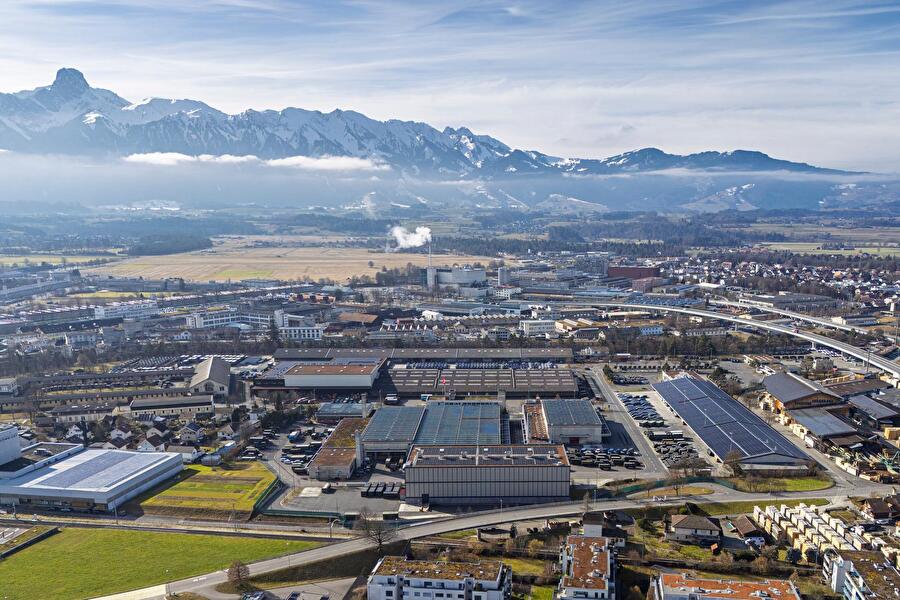
    Balz Halter ist Hauptaktionär und Verwaltungsratspräsident der Halter AG. Die Unternehmensgruppe der Schweizer Bau- und Immobilienwirtschaft beschäftigt rund 320 Mitarbeitende an den Standorten Schlieren, Bern, Basel, Luzern, Lausanne, Genf und St. Gallen. Der Ingenieur ETH und Jurist ist bekannt für Unternehmergeist und Innovationskraft. So hat sein Unternehmen «The Branch», ein Do-Tank und eine Kollaborationsplattform für eine innovative und integrierte Immobilienwelt, initiiert.

    Herr Halter, Ihr Unternehmen ist seit über 100 Jahren am Markt tätig. Was hat sich seither in der Stadtplanung verändert und was ist gleichgeblieben?
    Unverändert ist sicher immer noch die Anziehungskraft von Wirtschaftsmetropolen wie Zürich. Den Drang in die Stadt gab es schon vor 100 Jahren und er ist heute nicht geringer, wahrscheinlich sogar grösser. Es ist immer noch der gleiche Kampf um günstigen Wohnraum. Das wird ein ewiges Thema in allen Städten bleiben. Anders als damals macht man sich heute kaum Gedanken zu einer übergeordneten Stadtplanung und der Frage, wie sich Stadt über ihre politischen Grenzen hinaus entwickeln soll. Mit Aufkommen des Individualverkehrs und Ausbau der S-Bahnen wurde primär in Infrastrukturen gedacht und geplant. Entstanden ist die konturlose Agglomeration, die weder Dorf noch Stadt ist und ihre Identität sucht. Den Herausforderungen des Wachstums und die damit verbundene Not an zahlbaren Wohnraum begegneten unsere Ahnen vor 100 Jahren mit dem internationalen Städtebauwettbewerb Gross-Zürich, der sich weit über die damaligen Stadtgrenzen Zürichs erstreckte. Es wäre höchste Zeit, wieder einen derartigen Wettbewerb angepasst auf die aktuellen Anforderungen und Herausforderungen zu veranstalten.

    Gibt es hier vielleicht einen Wechsel durch die aufkommende Elektromobilität?
    Wir wissen, dass sich etwas verändern wird, aber wir sehen noch zu wenig klar, was da auf uns zukommt. Wie und wann sich Konzepte des Selbstfahrens, motorisierter Individualverkehr im Sharing-Modell kommen wird, wissen wir noch nicht. Wie dieser im Zusammenspiel mit öffentlichen Verkehrsträgern wie Tram, Bus und Bahn funktionieren oder diese sogar teilweise ersetzen werden, können wir noch nicht abschätzen. Es ist jedenfalls anzunehmen, dass diese Entwicklungen Auswirkungen auf die Stadtplanung haben werden, insbesondere auf den öffentlichen Raum. Möglicherweise werden weniger Parkplätze als Umschlagplätze gefragt sein.

    Im Wandel der Mobilität, von der Pferdekutsche bis zum Automobil und vielleicht sogar bis zur künftigen Drohne als individuelles Verkehrsmittel, muss man wie früher auch schon die Strukturen grosszügig planen, dann kann sich Vieles ergeben. Wir sehen gerade vor der Tür in Schlieren mit der Limmattalbahn oder auch im Glatttal die Wiedergeburt der Strassenbahn. Das ist möglich, wenn öffentliche Räume zur Verfügung stehen. Deshalb wäre es falsch, grundsätzlich von einem Paradigmenwechsel auszugehen.

    Faktor Flugzeug und Flughafen – wie strahlt das auf die Region Zürich und die Immobilienprojekte aus?
    Der Flughafen ist ein Treiber für Arbeitsplätze, Wohlstand und Prosperität. Wir verdanken wohl dem Airport Zürich auch, dass Zürich die Wirtschaftsmetropole in der Schweiz ist. Es war damals ein strategischer Entscheid, den Landesflughafen im Gebiet des damaligen Waffenplatzes Kloten-Bülach anzusiedeln. Davon profitieren wir alle heute in hohem Mass. Wir müssen diesen Vorteil weiter nutzen und dem Flughafen mit seiner Hub-Funktion Sorge tragen, so dass er direkte Verbindungen in alle Welt auch nach Corona bieten wird. Das Reisen wird wieder zunehmen, wenn auch nicht in dem rasanten Tempo, wie wir es zuvor erlebt haben. Der Flughafen Zürich hat eine enorm grosse Bedeutung und ich hoffe, dass das auch so bleibt.

    Braucht es einen Flughafenausbau, und falls ja, wie und wann?
    Im Wettbewerb der Volkswirtschaften ist die Schweiz als Binnenland und Exportnation auf diese Stärke angewiesen. Wir müssen den Flughafen als langfristiges Projekt verstehen, dass sich wandelnden Bedürfnissen anpassen kann und muss. Deshalb müssen wir planerisch und regulatorisch die Basis schaffen, dass ein weiterer Ausbau möglich bleiben wird. Ob das dann wirklich geschieht, steht auf einem anderen Blatt. Das können und müssen wir nicht heute oder morgen entscheiden. Aber die Rahmenbedingungen müssen mit Weitsicht gesetzt werden.

    Im Moment sind Lärm und Nachhaltigkeit sowie fossile Brennstoffe grosse Themen. Dank Fortschritt bei neuen Antriebsmodellen und bei der Energiegewinnung wird es auch in der Flugindustrie zu Veränderungen kommen. Es wird andere Kraftstoffe geben, die nachhaltiger sind. Die Lärmbelastung durch den Luftverkehr wird von Jahr zu Jahr weiter sinken. Auch deshalb können und sollten wir Weichen stellen, um einen Airport-Ausbau zu ermöglichen und Wachstum zuzulassen.

    In der Flughafenregion sind Sie zuhause und haben bereits eine Vielzahl an Projektentwicklungen mit Ihrer AG realisiert. Die jüngste in dieser Reihe ist eine Neuüberbauung in Wetzikon in unmittelbarer Nähe zum Bahnhof. Was ist hier der aktuelle Stand und was entsteht dort genau?
    Das Zentrum Metropol, so der Name des Projektes, ist in meinen Augen ein wegweisendes Vorhaben, das als Modell für Zentrumsüberbauungen in Subzentren dienen könnte. Aus der Sicht des Stadtentwicklers ist es deshalb spannend, weil wir es mit der Um- und Neunutzung eines Einkaufszentrums zu tun haben. Shoppingcenter kennt man aus den 1960er und 1970er Jahren und mit dem Projekt Metropol erfolgt in Wetzikon eine Neuinterpretation dieses Modells. Geplant ist ein neuartiges Einkaufskonzept, das auch nach aussen strahlt. Wir bauen einen Stadtbaustein, der die verschiedenen öffentlichen Räume vernetzt und das Leben dort unterstützt. Wir interpretieren Stadt quasi neu. Es wird nicht mehr ein in sich geschlossenes System sein, sondern ein offener, zugänglicher und vielfältiger Ort für alle. Die Nutzungen werden gemischt sein: neben Retail- entstehen Dienstleistungsflächen, Wohnungen sowie Angebote für Coworking und neue Formen des Zusammenarbeitens. Wir streben einen guten Mix an, so dass der Ort lebt, nicht nur zu Büro- oder Geschäftszeiten. Wetzikon soll an Attraktivität gewinnen, gegenüber den grossen Zentren Zürich und Winterthur, so dass die Leute in ihrer Stadt bleiben.

    Stichwort «Digitales Planen und Bauen»: Mit Raumgleiter besitzt Halter hier eine wegweisende und innovative Schwestergesellschaft. Was wird heutzutage noch analog gemacht und was bereits alles digital?
    Raumgleiter ist ein Pionier im Bereich Virtualisierung, digitaler Planungs- und Bauprozesse auf der Basis von 3D-Modellen, respektive des digitalen Zwillings eines Gebäudes. An diesen Themen arbeiten wir bei Raumgleiter, aber eigentlich in allen Unternehmen unserer Gruppe. Doch: Immobilien sind und bleiben real. Deshalb ist deren Realisierung und auch vieles im Betrieb analog und wird es auch in Zukunft bleiben. Die Digitalisierung hilft uns jedoch, die heute sehr komplexen, hoch fragmentierten Bau- und Betriebsprozesse neu zu gestalten. Das Ziel muss sein, dass Gebäude effizienter und nachhaltiger erstellt und betrieben werden können, in hoher Qualität und ausgerichtet auf die tatsächlichen Bedürfnisse ihrer Nutzer. Wir stehen noch am Anfang: die Digitalisierung bietet unserer Industrie jedoch ein enormes Potenzial.

    Welche Rolle spielt dabei der von Ihnen mitinitiierte Do-Tank «The Branch»?
    Im Branch kommen viele verschiedene Beteiligte aus der Bau- und Immobilienwirtschaft zusammen: Unternehmer, Dienstleister, Bauherren, Investoren und finanzierende Institute. Wir als Halter-Gruppe sind auf Planer und Unternehmer angewiesen, wenn es um die Entwicklung und Realisierung von Gebäuden geht. Deshalb müssen wir Partner haben, die denken wie wir und die bereit sind, neue Prozesse, Produkte und Tools zu entwickeln und auszuprobieren. Deshalb laden wir Gleichgesinnte aus der Branche ein, auf unserem Weg in die Digitalisierung mitzumachen und durch innovative Konzepte neue Geschäftsmodelle, Berufsbilder und Plattformen zu schaffen und zu gestalten. Wir sind ein Do-Tank. Es geht nicht nur darum nachzudenken, sondern konkret zu handeln. Das können gemeinsame Pilotprojekte sein oder sogar gemeinsame Unternehmungen. Diese Initiative ist auf sehr offene Ohren gestossen. Wir haben enormen Zulauf von Bauunternehmern, Zulieferern, institutionellen und privaten Investoren und Planern. Wir sind auf einem sehr guten Weg, ein neues Verständnis und neue Denkmodelle in unsere Industrie hineinzubringen. Ziel ist es, über die Innovation hinaus unsere Wirkung zu verbessern, insbesondere auch bezüglich Nachhaltigkeitsaspekten und einer zirkulären Wirtschaft.

    Vieles in der Digitalisierung hängt scheinbar von gemeinsamen Standards ab. Sollten diese national oder besser international sein?
    Ich glaube, man überschätzt die Möglichkeiten einer Standardisierung, eines technokratischen Ansatzes in einer Zeit der sich rasch wandelnden technischen Möglichkeiten. Es ist verführerisch zu sagen, wir handeln alle gleich und wir denken alle gleich. Aber die Bauindustrie ist extrem regional und wenn man diese international und global betrachtet, findet man so viele unterschiedliche Kulturen, Usancen, aber auch Normen und Standards. Man kann sehr viel Energien verschwenden, wenn man versucht, den einen gemeinsamen Standard zu bauen. Man muss sich vielmehr an der Denkweise der Softwareindustrie orientieren. Dort ist nicht die Frage, ob alles nach dem gleichen Modell funktioniert, sondern wie kann man das «Handover» zwischen den verschiedenen Lösungen mit den richtigen Programmierschnitt- stellen hinbekommen. Am Ende werden sich aus diesen technischen Innovationen auch gewisse Industriestandards formieren. Diese sind dann nicht kraft Definition entstanden, sondern aus Bewährtem im Arbeitsalltag.

    Wie schaut Raumplanung und Stadtentwicklung in 20, 50 oder gar 100 Jahren dann aus?
    Ich bin kein «Digital Native» und keiner, der sich in den «Metaverses» herumtreibt. Aber auch zukünftige Generationen werden reale Geschöpfe bleiben und in der analogen Welt leben. Daran wird sich nichts ändern. Deshalb lohnt sich ein Blick zurück und zu schauen, wie Städte vor 100 Jahren gebaut wurden. Sie sind damals menschengerecht geplant und realisiert worden. Wir leben noch heute in diesen Städten und schätzen gerade diese bewährten Stadtstrukturen und Quartiere sehr. Natürlich verändern sich Möglichkeiten und Bedürfnisse. Die Grundstrukturen funktionieren aber noch, die wesentlichen Elemente, die Stadt ausmachen, bleiben die gleichen. Das ist vor allem am öffentlichen Raum abzulesen, den man früher mit Grosszügigkeit und Weitsichtigkeit, aber auch zuweilen mit einer gewissen ‘Verengtheit’ geplant hat. Das sind heute spezifische Qualitäten, die wir sehr schätzen.

    Wenn man Bilder vom Zürcher Bellevue vor 100 Jahren anschaut: Das war ein riesiger Platz, wo nicht viel passierte. Irgendwann kam das Tram, die Pferdekutschen verschwanden und dann sind die Autos, Zweiräder und Busse dazugekommen. Das konnte alles aufgenommen werden und funktionierte. Man muss offen sein für künftige neue Bedürfnisse und auch neue technologische Möglichkeiten. Grosszügige öffentliche Räumen schaffen Identität, Flexibilität und die Chance neue Entwicklungen zuzulassen. Das ist eine Qualität, die auch den Menschen gerecht wird und die die Attraktivität der Stadt ausmacht. Wenn wir an den bewährten Grundelementen weiterarbeiten, wird die Stadt in 100 Jahren zwar grösser und vielzähliger, aber nicht deutlich anders ausschauen. Gewisse Flächen und Räume werden anders bespielt werden als heute. Aber die Anziehungskraft von Städten wird bleiben.

  • Superblocks make cities more livable

    Superblocks make cities more livable

    A study by the Swiss Federal Laboratories for Materials Testing and Research ( Empa ) examined which cities have the potential to be transformed using superblocks. This means of urban planning can counteract increasing heat, noise and air pollution and dwindling green spaces due to climate change or population growth. Urban planning is key, study author Sven Eggimann is quoted in a statement by Empa: “The design and use of street space influences the quality of life of residents and has the potential to significantly improve the urban climate.”

    Barcelona is a model for the formation of superblocks. There, ideally, 3 by 3 blocks and their inner courtyards are combined into a super block. The development traffic is routed around the outside, the inside remains completely car-free. Instead of streets and parking lots, bicycle paths and footpaths, green areas and meeting zones will be created. In addition, heat-reducing measures can be implemented.

    According to Eggimann, the potential of this urban design is so high because streets make up a significant part of the total area in today’s urban areas. In European cities, this is typically between 15 and 25 percent.

    Eggimann calculated the superblock potential of individual cities with values between 1 percent and a third of the streets. Cities such as Mexico City, Madrid and Tokyo showed the greatest potential. However, according to Eggimann’s study, cities whose streets are laid out less grid-like than in Barcelona are also suitable for super blocks: “This offers the opportunity to make urban districts more attractive by putting people and not vehicles at the center.”

  • Lucerne University of Applied Sciences tests augmented reality for urban planning

    Lucerne University of Applied Sciences tests augmented reality for urban planning

    Together with the City of Lucerne, the Lucerne University of Applied Sciences and Arts is testing the potential of augmented reality (AR) in urban planning. To this end, the university has developed an AR visualization of possible redesign measures in Bahnhofstrasse and Theaterplatz. For example, the projected second row of trees, the new Velostation and the mobile seating including planting could be experienced visually, according to a press release from the university.

    The research groups Visual Narrative from the Department of Design & Art and Immersive Realities Research Lab from the Department of Computer Science as well as the Civil Engineering Department of the City of Lucerne were involved in the joint project. It has now been presented to the media. Presentations for the general public will follow on three days in September.

    The AR visualization can be used on common tablets. The real environment appears on the display with virtual objects projected over it. Planned structural interventions can be viewed three-dimensionally and spatially. “Users can experience on site how Bahnhofstrasse could be designed and used in the future without any real structural or other interventions being necessary,” project manager Tobias Matter is quoted in the press release.

    This would give all decision-makers from different areas the opportunity to take an uncomplicated and active part in the planning. In contrast, plans, models and specialist vocabulary are not immediately understandable for everyone. “The immersive visualization technology of augmented reality can thus be an effective tool to inform the public more transparently about construction and renovation projects, to encourage their participation in the planning and ultimately to create more acceptance for such projects among all those involved,” said Matter .